


Howell No. 5 Voting District, Howell County, Missouri
About
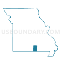
Outline

Summary
| Unique Area Identifier | 608052 |
| Name | Howell No. 5 Voting District |
| County | Howell County |
| State | Missouri |
| Area (square miles) | 74.15 |
| Land Area (square miles) | 73.73 |
| Water Area (square miles) | 0.42 |
| % of Land Area | 99.44 |
| % of Water Area | 0.56 |
| Latitude of the Internal Point | 36.70367970 |
| Longtitude of the Internal Point | -91.89469160 |
Maps


Graphs
Select a template below for downloading or customizing gragh for Howell No. 5 Voting District, Howell County, Missouri


Neighbors
Neighoring Voting District (by Name) Neighboring Voting District on the Map
- Benton No. 2 Voting District, Howell County, MO
- Dry Creek Voting District, Howell County, MO
- Howell No. 1 Voting District, Howell County, MO
- Howell No. 2 Voting District, Howell County, MO
- Howell No. 3 Voting District, Howell County, MO
- Howell No. 4 Voting District, Howell County, MO
- Howell No. 6 Voting District, Howell County, MO
- Howell No. 7 Voting District, Howell County, MO
- South Fork Voting District, Howell County, MO
- Spring Creek Voting District, Howell County, MO
Top 10 Neighboring County Subdivision (by Population) Neighboring County Subdivision on the Map
- Howell township, Howell County, MO (19,681)
- Benton township, Howell County, MO (2,127)
- Spring Creek township, Howell County, MO (1,972)
- Dry Creek township, Howell County, MO (1,777)
- South Fork township, Howell County, MO (1,109)
Top 10 Neighboring Place (by Population) Neighboring Place on the Map
Top 10 Neighboring Elementary School District (by Population) Neighboring Elementary School District on the Map
- Fairview R-XI School District, MO (4,501)
- Richards R-V School District, MO (3,369)
- Glenwood R-VIII School District, MO (2,362)
- Howell Valley R-I School District, MO (2,005)
Top 10 Neighboring Unified School District (by Population) Neighboring Unified School District on the Map
Top 10 Neighboring State Legislative District Lower Chamber (by Population) Neighboring State Legislative District Lower Chamber on the Map
Top 10 Neighboring State Legislative District Upper Chamber (by Population) Neighboring State Legislative District Upper Chamber on the Map
Top 10 Neighboring 111th Congressional District (by Population) Neighboring 111th Congressional District on the Map
Top 10 Neighboring Census Tract (by Population) Neighboring Census Tract on the Map
- Census Tract 908, Howell County, MO (6,368)
- Census Tract 906, Howell County, MO (5,182)
- Census Tract 907, Howell County, MO (5,008)
- Census Tract 904, Howell County, MO (4,849)
- Census Tract 905, Howell County, MO (4,762)
- Census Tract 903, Howell County, MO (4,680)